Campground Trail, Lost Mine Trail and Boquillas Canyon
February 6, 2021
Yesterday was a big day at Big Bend so today we are chilling at the campground today. Our hike will be in our "backyard", we are going two miles up and back to see the view.

The trail starts at the back of the campground with a stone lined path.

Mountains are all around.
Here take a spin with me

Cool rock formations


As we walk this mesa seems to turn with us.

The white mountains seem to stand out.

The trail of course goes up, it is wide enough for a vehicle, but no vehicles are allowed on the trail.
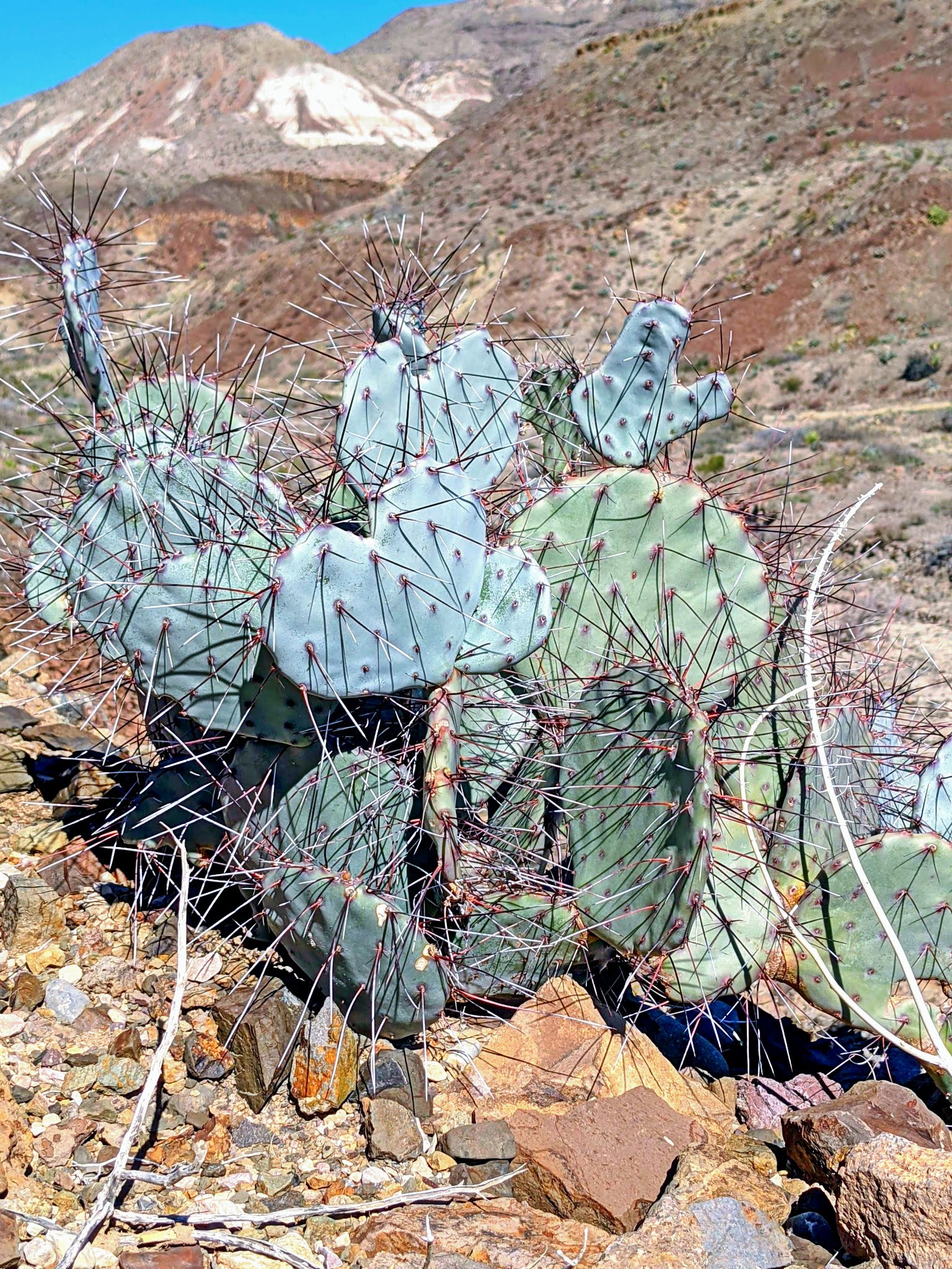
This catcus has some serious spines.
"Glochids or glochidia (singular "glochidium") are hair-like spines or short prickles, generally barbed, found on the areoles of cacti in the sub-family Opuntioideae. Cactus glochids easily detached from the plant and lodge in the skin, causing irritation upon contact."
Fortunately, I did not touch it. (but photo-shopped by another)


It is a clear day and we can see mountains in the distance as well.

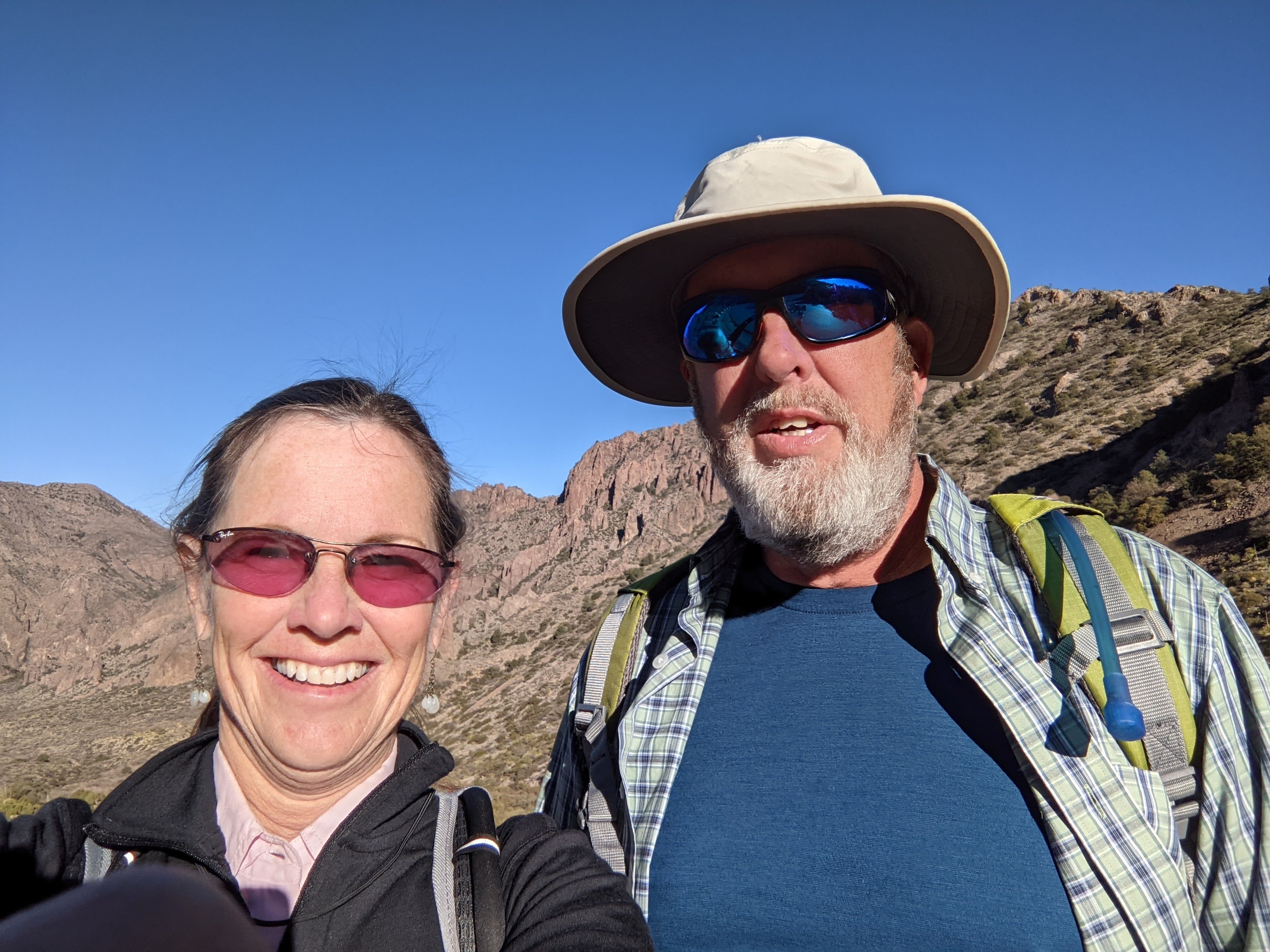
Selfie shot with this dark range on the top of the hill we are climbing.

Meanwhile, Jim makes good use of his time and uprights this fallen marker.

From the top looking over at the long mesa.

There is even a picnic table up here. We did not pack a lunch today, just water.

The open area down there is our campground. The red roof is a house with a great view.

Smiling at the picnic table, another good climb.


Here is our route, it was one way so the same path up and down.
Our time is long because we met two other hikers and stopped and chatted with them for awhile.


The campground we are at gives us the use of the resort facilities here as well.
We will have to stroll over there on another day to check them out.
February 6, 2021
Today we headed back to Big Bend to hike the Lost Mine Trail.
The alarm went off at 7:00 am, the sun was not yet up and it was 40 degrees out. Reset the alarm for 7:30 am, suns up and so are we. I packed a picnic lunch and gathered the camelbacks (water back packs) and hit the road for the Chisos Basin Area of Big Bend National Park. We made the turn to Chisos Basin and passed a full parking area for the Lost Mine Trailhead. Fortunately 0.2 miles down the road was a a pull out area which was enough area to park more cars.

Nice view here, this is not our tailgate, you can see our white hood.
It's sunny and around 55 degrees as we set out.

First 0.2 mile walking up the road to the trailhead.

Jim has named the formation behind him the Organ Pipes.

Every turn reveals another cool rock formation.

"The volcanic Chisos (chee-sos) Mountains are a world apart from the low Chihuahuan Desert. A mountain island surrounded by a hot desert sea, the Chisos cover more than 40 square miles of forested slopes, rugged canyons, and rocky spires."

The trail is rocky, of course, and uphill.

The temperatures climbed as we did but a breeze kept us comfy.

Spectacular views

"According to legend, a rich ore body was discovered on the highest point of Lost Mine Peak. Life-term prisoners were forced to work the mine. These men were blindfolded on several occasions in their march from the Presidio in San Vicente, Mexico, to prevent them from learning its location."

"A story relates how the fierce Comanche Indians, who resented the Spaniards’ invasion of their homeland and hunting grounds, attacked and killed them to the last man. The last act, so goes the story, was to seal the mine entrance to prevent further exploitation."

This tower of rock has an interesting notch in it.

So happy to be out on this marvelous day on the Lost Mine Trail.


The colors in this rock area was cool.

Artsy attempt of adding tree and cacti in the mountain shot.

Headed back down the mountain.

Views were great going up and going down.


After completing the Lost Mine Trail we went to Chisos Basin and had some lunch.

We took a small trail called Window View.

This pile of rocks had enough room for trees to grow on it.

The peak between the mountains is the Window.

The basin is surrounded by mountains.
Here's a video so you can see for yourself.

We also spied a roadrunner who didn't mind having his picture taken.

And a blooming cactus.
February 8, 2021
Today we travelled to the east end of Big Bend National Park to hike Boquillas Canyon.

Since we are staying on the west side in Lajitas, Texas it means crossing the width of the park.
Fortunately the sky is blue and the views are grand.

Here on the east side there is even a tunnel you drive thru just before the Rio Grande overlook.

The cactus here have long red spines.

"You are looking across the Rio Grande floodplain toward the wild reaches of Mexico's Sierra del Carmen" No view of the Rio Grande river here, just the floodplain.

El Pico is the triangle on the left
the long mesa is Sierra del Carmen (in Mexico)

We are headed east, see the winding road, that is where we are going.
We are going to take a short hike before we get to the canyon, the Rio Grande Nature Trail

"0.75 miles round trip 80 feet elevation gain
The Rio Grande Village Nature Trail crosses two boardwalks spanning beaver ponds, and then ascends to the top of a small hill, offering vistas of the Sierra del Carmen and Chisos Mountains."
We did not see any beavers.

" The ponds are fed by warm springs, with the uppermost pond providing habitat for the endangered Big Bend Gambusia, or Mosquito Fish."
We did see the fish, he is small, but the clear water allowed us to see several. This one is the largest one we saw.

The distant mountains are Mexico.

We are so close, Mexico is on the other side of the river. Crafts made in Mexico are placed along the side of the trail with prices and a cup to put the cash in for anything you want to buy.
There are several "stores" along the path, similar items different vendors.


view of Mexico from the top of the trail

Another couple on the trail took this photo of us.

The Rio Grande River, today it was shallow and easy to cross.
We saw several people on horses crossing to check on their "shops"

You can see the RV campground on the right hand side. We tried to reserve a site here but it was full. That worked out since our RV park while outside the park has a better view.
Onward to the canyon.

"The Boquillas Canyon Trail climbs a series of steps to overlook the Rio Grande, then descends to the river floodplain. There, it dissolves into a collection of smaller footpaths until the beach ends and the river meets the canyon walls."


One of the crafters working in Mexico just across the river.

Since I walked on the U.S. side all shots across the river are of Mexico.

Unlike the Santa Elena Canyon Trail which was shady,
Boquillas Canyon Trail was all under the hot sun today.

Still smiling in the hot sun, 81 degrees today.

See how shallow the river is, not hard to cross.


Jim on the trail

Where the canyon walls enclose and our trail ends.

A couple of saddled up horses in Mexico.
It was a good trail.
Time to head back west.

And so wraps up our adventures in Big Bend National Park.
For all you adventurers, I want to mention that we used an app while in Big Bend called Just Ahead. It was helpful while driving around mentioning roads coming up and what could be seen there.
It was free for Big Bend, they have other parks as well, check it out.
some great shots of your adventures in Big Bend
ReplyDeletejust looked at resort amenities...is everything open? How about a horseback ride or what's the Cowboy Action Shoot?
ReplyDeleteToday was resort day for us (blog to come). Everything is open. We hiked ourselves, did not ride horses, and personally not interesting in shooting but I did talk to someone who did and he loved it.
DeleteFirst Lost Maples. Now Lost Mine. So many absent-minded people!
ReplyDeleteLooking forward to photos from Lost Keys.