Moab, Canyonlands, and Dead Horse Point State Park
March 4, 2021
Today we are going into downtown Moab to do some laundry and check out the town. The laundromat was a busy place but we were able to get in and out efficiently and then stroll Moab.
Moab has an art sculpture walk around town. Here is my favorite one.
This one was outside of a bike themed restaurant named Spokes on Center.
This one is Jim's favorite one.
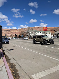
Main Street is US 191 and it is even busy now without a lot of tourists in town.
Downtown Moab is surrounded by Red Rock formations.
Town is full of hotels, restaurants and sports rental places.
Of course the Moab Food Truck Park caught our attention.
All of the food trucks were not open, but we found a delicious choice in Paninis Plus.
I had a Caprese Panini (Fresh mozzarella cheese, roasted tomatoes, fresh basil, house sauce) while Jim enjoyed a Papichi Panini (Capicolla ham, salami, pepperoni, provolone, mozzarella, pepper jack, roasted red peppers with pesto & house sauce). Yum
March 5, 2021
Today we went to Canyonlands National Park, a 45 minute drive from our campground. We are at the Island in The Sky section. "The Island in the Sky is a huge, level sandstone mesa situated between the Green and the Colorado Rivers separated from the rest of the Colorado Plateau by a narrow strip of land named the Neck. The Neck is 40 feet wide and is the only connection the Island in the Sky has with the main plateau. The land drops 1,000ft to the basin below. Without the Neck, it would be a true island."
The first stop on the scenic drive, Shafer Canyon Overlook.
Here we are happy hikers at Shafer Canyon overlook.
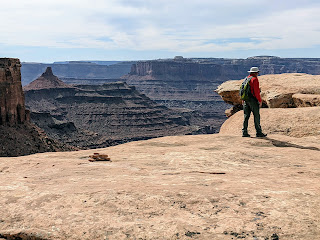
What a view.
The La Sal mountains can be seen from here as well.
side wall at Shafer Canyon overlook
Here is a video so you can see it all for yourself.
This is White Rim Road, for 4 wheel driving into the canyon.
No we did not take this road, we hiked along the scenic drive up top.
"The road below you hugs the walls of Shafer Canyon as it quickly drops 1,400 feet. Today the Shafer Trail provides access to Canyonlands' backcountry and the 100-mile White Rim Road. Travelers who descend these switchbacks continue a legacy of exploration and survival as they follow historic pathways through the desert canyons."
Another view from Shafer Canyon overlook, you can see the White Rim Road too.
Gorgeous.
Next stop Mesa Arch
"A lone span clinging to the canyon rim, Mesa Arch has greeted every sunrise for millennia. Repeated cycles of freezing and thawing created this geologic rarity as water seeped through cracks in the sandstone cliff. Eventually, these same forces will lead to its collapse."
Us enjoying the views under Mesa Arch.
The arch is not nearly impressive as the views it frames.
So here is a partial arch with a view.
Here is Mesa Arch from further back
views from the Mesa Arch trail
Next stop Buck Canyon Overlook,
hey there is a reason this park is called Canyonlands.
More great views, they are everywhere.
Hold on to your hats, the next stop is GRAND VIEW Point Overlook.
The area here is called Monument Basin
We hiked the Rim Trail, which was right along the rim.
This rock is balancing on it's edge.
The trail comes with some built in steps.
the views into the canyon from the trail
The end of the trail, where the Island in the Sky ends and the canyons come together.
The sun caused some of this video to be a little hazy, but that is life in the sunshine.
Happy hikers
A slim section of the trail between the rocks.
Monument Basin
Clever use of dead trees to make a fence line.
This portion of the trail seems more narrow on the way back.
Time for lunch. Friday in Lent calls for some egg salad for Jim while I enjoy a peanut butter and banana low carb roll up.
Time to hike up to Upheaval Dome.
The trail is uphill of course, and a bit rocky.
"Upheaval Dome is a mystery. The rock layers below you are fractured and tilted, forming a circular depression more than two miles wide. How did it form? Scientists propose two potential causes: a salt dome that cracked and tilted the rock over time, or a violent meteorite impact that instantly fractured the rock. Recent findings support the meteorite hypothesis, but questions remain. With more research, we may solve the mystery of this crater and others on our planet."
View from the Upheaval Dome Trail
I am at the first overlook, the top of that hill is where the 2nd overlook is
To the 2nd overlook we go.
the trail lined with rocks so you can follow it
I took a few moments to analyze the trail and persevered.
Once at the top, Jim went out on a rock
I felt more comfortable on the solid ground in the center of the rock top.
Still not sure how a meteor hit resulted in these white hills.
Okay on to the last stop of the day, Green River Overlook.
Here we are at 6,000 feet looking down on the Green River.
"In May 1869, Major John Wesley Powell set out on a remarkable mission: to explore the uncharted canyons and waters of the Green and Colorado rivers. Powell, a geology professor and one-armed Civil Var veteran, began the journey with nine novice oarsmen and four wooden boats. He ended the journey three months later with two boats, six men and detailed knowledge of a unique landscape that would capture national attention.
As they first entered the wilds of canyon country, Powell wondered in his journal, "What shall we find?” When Powell's party reached this section of the river in July, he described a "strange, weird, grand region" of naked rock with "cathedral-shaped buttes, towering hundreds or thousands of feet, cliffs that cannot be scaled, and canyon walls that shrink the river into insignificance."
Powell's voyage opened a world of adventure and scientific discovery that continues today. "
Views at the overlook for Green River
We have had a great day exploring Canyonlands National Park.
I hope you enjoyed our photos.
March 6, 2021
Dead Horse Point State Park sits adjacent to Canyonlands National Park.
First stop the Visitor Center, looks pretty sleek here on the rim of the canyon.
The rangers help us get situated and suggest a couple of trails.
We started out right here at the visitor center for the first three hikes.
It is a short nature trail with great views of the canyon from the East Rim.
The walls here are triangular shaped walls with a flat top.
See the very boxy and tiered lakes these are
"Solar Evaporation Ponds - those bright blues on the desert floor are solar evaporation ponds for a mine owned by Intrepid Potash, Inc. Potash is potassium chloride, a salt found in the Paradox Formation. Salt deposited from ancient seas made up this formation as it evaporated and was
buried by other sediments. Water is pumped down into the formation to dissolve the salt. This salt water is then pumped into the shallow, vinyl-lined ponds you see below. A blue dye is added to speed up evaporation. The dry desert air and many sunny days make this a productive operation. Twenty-ton scrapers, guided by lasers, harvest the dry salt. A local refinery transforms this concentrated form of potassium chloride into plant fertilizer." We did not see the scrapers at work.
You can spy a little of the Colorado River, just one bend of it. "The Colorado River, as seen here 2,000 feet below Dead Horse Point, carved out this entrenched meander of canyon walls over the course of 10 to 15 million years." Hard to picture from the slow moving river it is today.
It's breezy and a little chilly this morning with clouds.
We take the ranger's advice and hike to Big Horn Overlook which is a West Rim Trail.
It is just a short distance before we see the canyon on the West side.
There seem to be more circular swirled rocks over here.
The canyon is gorge-ous
We climbed up to the highest vantage point and here in a well trees are growing.
Jim meanders confidently around up top.
I choose to take photos from a little further off the edge.
The canyon is spectacular
Jim between two canyon rock formations.
There are even a few trees fully grown up here.
Actually it's pretty green up here.
But there are still lots of rocks.
After having some lunch we hike the Colorado River View Trail
You get the same view as from the visitor center just from the side.
"Water has eroded and weathered the sedimentary rock of this region for millions of years. As water seeps into the rocks, it dissolves the cementing minerals that bind the sand grains, allowing them to be carried away. The sand grains then enter the flow of the Colorado River and turn the water into an abrasive solution like liquid sandpaper. The fast current of the gritty river carves through the rock, deepening the canyon."
It is still a pretty view.
The sunny is starting to break thru so we have pared off our outer layers.
We drove down to Dead Horse Point Overlook and were not disappointed.
From here we could see several bends of the Colorado River.
And canyon as far as the eye could see.
The rocks here run from 175 million years old to 275 million years old.
It takes a lot of time to make something this beautiful.
Here you can see more of the White Rim Road that some people drive on at the bottom of the canyon.
Dead Horse Point State Park, well worth the stop.
A lazy Sunday before we hit the road tomorrow.
I took a short stroll near the campground.
The La Sal Mountains were just across the street.
These red rocks are right behind our campground.
Jim washed the truck- even the car wash has a view.
Moab, Utah has been good to us. If you are thinking of coming out here, try to come in early March, the weather was great and the crowds low during the week. Saturday at the state park had plenty of people but it wasn't too crowded. We did pass a long line of cars waiting to get into Arches at 10 in the morning on Saturday. I am sure once Spring Break comes around it will fill up.


Comments
Post a Comment