Yosemite
March 31,2021
We leave for Yosemite tomorrow, so its off to Fresno to get a haircut for Jim and some groceries.

The views on the way back are lovely.


We needed to make a few adjustments to dump at this site, since it wasn't quite downhill to the sewer, ah the oddities along the way. It is a good thing that we are resourceful and can think on the fly.
April 1, 2021
Travel day.

We drove through miles of orange groves.

Not sure why these trees are covered, does anyone know?

Great looking bank building with clock tower in Oakland, CA

A river/lake on our way to Yosemite
(taken thru my windshield so that is not a UFO but a bug on the windshield.
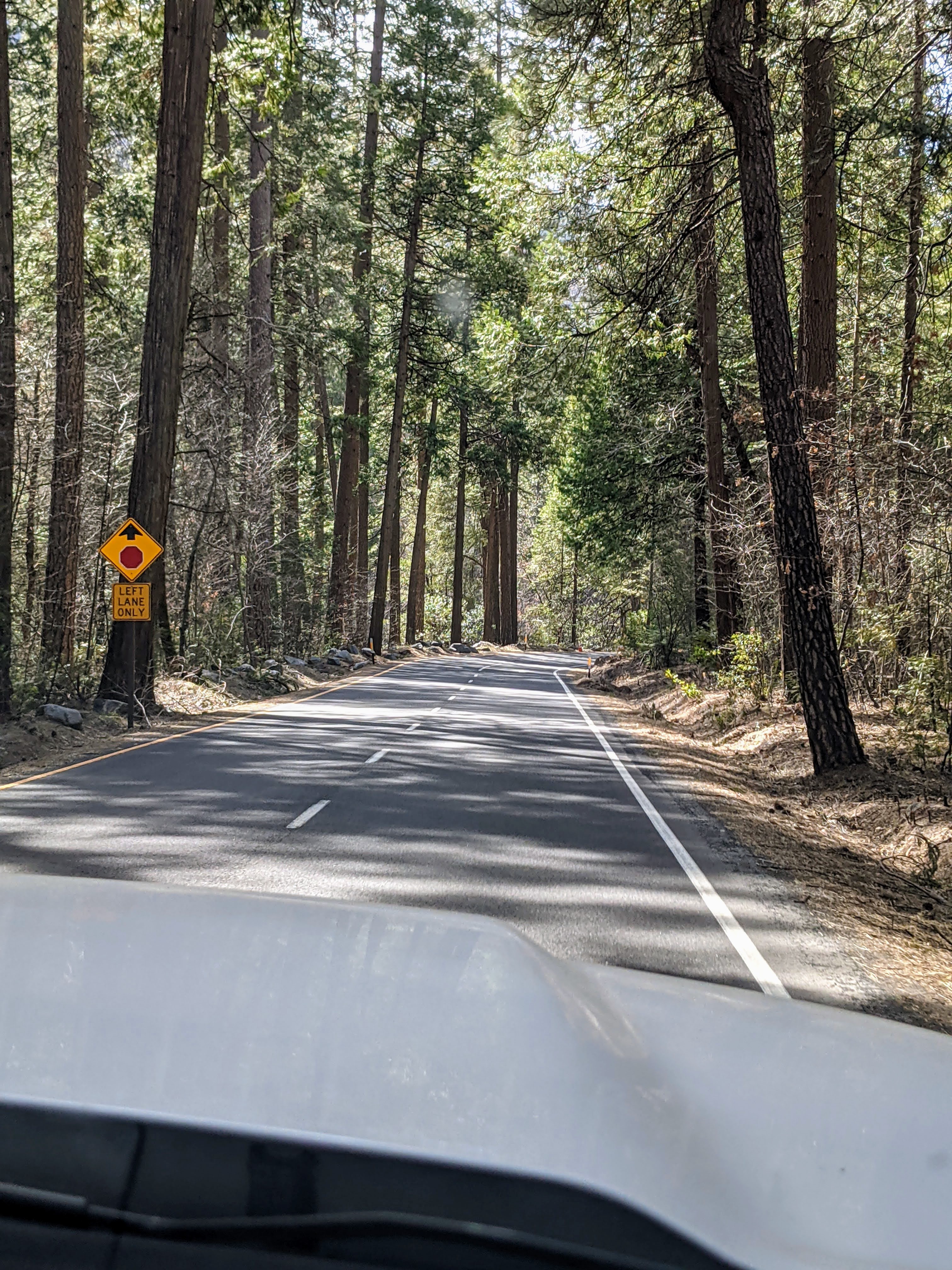
We came in on Hwy 120, oh my what a twisty uphill climb that was. It is the only way in here and it is intense while towing a trailer. No photos taken I was busy praying for a safe journey.

Our spacious site here at Yosemite Lakes RV in Groveland, CA outside the west entrance to Yosemite. It is spacious because currently we do not have neighbors to the left or right.

The south fork of the Tuolumne River runs thru the campground with a trail along one side.
April 2, 2021
Yosemite! It has taken us a long while to get out to Yosemite, so far from home, but we have persevered and are finally in Yosemite Valley today.

Our first view from the road into Yosemite, it is definitely a Valley.

Bridalveil Falls is the first waterfall we come upon. The trail is closed so we will not be able to hike to the base of the falls. :(

The pull off for Bridalveil Falls has access to the Merced River that flows thru the Valley.
"Early Spanish explorers named the Merced River for Our Lady of Mercy. In Yosemite Valley, later settlers saw the Merced and its tributaries as troublesome as well as merciful. They channeled the wild river, dynamited the glacial moraine at the Valley entrance to lower the water table, and diverted water to quench the thirst of livestock and to power a sawmill."
Merced River video
Okay, so Yosemite does not mean the sound of water. "Yosemite means literally “those who kill” (Yos, “to kill,” the modifier e, “one who,” and the plural suffix -meti). It was used by the surrounding Miwok tribes." My meaning is directed more towards me and this National Park full of moving water in the Springtime.

There are great views of the granite mountains around us from the Bridalveil Falls turnout.

Upper Yosemite Falls pops up right away. You don not have to work for it, you can see it from almost everywhere.

What, wildlife, we have been to lots of national parks, but have not seen much wildlife. It's nice to see the deer here.

Jim and I, all smiles at seeing Upper Yosemite Falls.

The trail to Lower Yosemite Falls is an easy paved path, with lots of other visitors.
"The Falls begin as snow in the granite reaches of Yosemite wilderness. When the snow melts each spring, Yosemite Creek transforms into a free-falling torrent. Watch the comets of spray. Hear the water roar. And from the Lower Fall Bridge, feel the shower of a lifetime!"
A video of Lower Yosemite Falls

Both Upper and Lower Yosemite Falls can be seen if you back up far enough.

The flow out of the falls is tremendous. I love a good snow melt that has the waterfalls full of water.

"Like giant bulldozers, Ice-Age glaciers carved and plucked rock from Yosemite Valley's granite walls. As the glaciers receded, "hanging valleys" were left behind. The streams from these ancient valleys now flow over waterfalls - like Yosemite Falls."

"To the right of Upper Yosemite Fall, you can see a finger of granite known as the Lost Arrow. Its name comes from a story about a deer hunter who was in the high country celebrating his conquests. From the cliffs above the Valley, he shot a victory arrow into the air. When the wayward point dropped to the ground, it turned to stone."
Our second trail is in Cook's Meadow

Cook's Meadow
"From 1881 to 1887, John J. Cook, a businessman from New York, operated a hotel in Yosemite Valley. The hotel was originally owned by George Wright and Walter Cooke. J.J. Cook saved money by retaining the original sign when he took over the hotel's operation. He used this meadow to graze livestock, and the meadow still bears his name. It's hard to imagine cows in Yosemite Valley. But in the late 1800s, horses and mules transported tourists to the Valley, while cattle and sheep supplied hotels with milk and meat. Early pioneers planted crops in this meadow. They also allowed their livestock to graze here. These practices compacted the soil and damaged meadow plants. After grazing was eliminated in Yosemite Valley in the late 1920s, the native vegetation returned. "
Okay let's take a look at what lays around the outside of the meadow.

And here is Half Dome
"Millions of years ago the granite block of Half Dome was larger, but there never was a matching half. Undercut by glaciers near the base, slabs of rock fell away from a broad vertical crack in the granite, leaving a sheer face. Remnants of the missing rock still project from Half Dome's rim.."

Granite reflected in the river.
Our third trail of the day will take us to Vernal Fall


The Merced is flowing fast here along the Mist Trail

The mighty mountains line our route to Vernal Falls

The Falls are really causing the river to race.

There are several choices of trails here. We are taking the shortest one to Vernal Fall Bridge. Its cold up at the higher elevations and the only winter trail open to Nevada Falls looks killer and maybe covered in ice, maybe next time we visit Yosemite.

Rock piles are everywhere.
"The cliffs above seem eternal, but the jumbled rock piles at their base, called talus, tell a different story. Over time, the cliffs shed boulders, pebbles, and sand and they tumble down."

The fallen rocks in the river are my favorite as they cause lots of water music.

View on the Mist Trail to Vernal Falls

Vernal Falls

Flow from Vernal falls is fierce today

It is splashed around all the boulders at the footbridge.

Whitewater churning at the base of Vernal Falls

Me on the footbridge with Vernal Falls in the background.
Crazy in love with all the churning water.

View away from Vernal Falls from footbridge.

And on the hike back down, this far off waterfall doesn't have a name, it just snowmelt.

Happy hikers

Another look at Upper Yosemite from Mist Trail.

Down in the valley we see all the shuttle buses parked. They are not running due to concerns about CoVid. This means more walking for us to get to some Trailheads that are on roads that only the shuttle buses run on (no car access to these roads).

Now this has a name, it is El Captain (El Cap)
"The granite monolith is about 3,000 feet from base to summit along its tallest face, and is a popular objective for rock climbers." 25 people have died on El Captain.

On the way out we are treated to another viewpoint for Bridalveil Falls.
I like this view even more than the first one even if it is farther away from the falls.

"Po-ho-no
The 620-foot Bridalveil Fall inspires sightseers to capture a photograph, feel the spray of waterfall mist, or learn the stories of those that have come before. The first people of this Valley, the Ahwahneechee, called this waterfall Po-ho-no, or "puffing wind.” To them, this was a place of foreboding where evil spirits resided. In more recent history, Euro-Americans renamed it Bridalveil Fall because of the veil-like effect when wind tosses the waterfall in the air. "
Time to head out of the park for the day.

Turnout for a peek at Cascade Creek. Well worth a stop to look.

Cascade Creek, now that's a lot of water flow for a creek.

view from Cascade Creek, not too shabby
Yes, indeed another good day.
April 3, 2021
The National Park Service and the City and County of San Francisco have a long-standing relationship of sharing protection of the natural resources and water quality at Hetch Hetchy Reservoir and throughout its 459-square-mile watershed.

O'Shaughnessy Dam, how San Francisco gets its water. Not too good looking on this side.

As we walk from our parking spot to the dam, we start to see Hetch Hetchy Reservoir.

Okay, this side of the dam is very pretty.

On the left is Hetch Hetchy Dome and on the right Kolana Rock.
We kept calling Kolana Gibralter; see the resemblance?

And over on the left you can see the whitewater of Wapama Falls, after I zoom in. With the naked eye it was easy to see across the lake.

The top of the dam is wide and open to pedestrians.

Jim is checking things out from the top of the dam.

We are ready to start our hike to Wapama Falls, first step is into the tunnel at the far end of the dam.

There is water on the ground, seeping in from the walls and roof.
There are lights, but it is darker then outside and takes a minute for our eyes to adjust.

We are ready to hit the trail.

The trail is along the reservoir, flat and wide here at the start.

We catch a glimpse of some snow melt along the hillside.
A warm-up for the falls ahead.

The trail has gotten very rocky and is starting to ascend.

One mile in and we see the options open to us. Hmm walking 47.5 miles to Yosemite Valley seems tempting but no I will just go to Wapama Falls thank you.

We are at the far end of the reservoir and can start to see what is beyond Kolana Rock.

Wildflowers pop up along the trail every now and then.

Tueeulala Falls cascades more than 1,000 feet down the hillside.

Jim uses the rocks to avoid the stream from Tueeulala Falls

The outflow from Tueeulala Falls

Tueeulala Falls is wide but not a lot of waterflow.

Some trees grow along the rocky hillside.

Snowcapped mountains pop up beyond Kolana Rock.

We could hear the falls long before we could see them, at this point the falls were spraying mist on us.

The upper and middle section of Wapama Falls

So much water is coming down, it is stunning.

Water is splashing around rocks

A view thru the side of the bridge going into Hetch Hetchy Reservoir.

The first bridge is just that, the first, then there is a stone wall, another bridge, another stone wall, another bridge, another stone wall. Five bridges in all. Fortunately for me the bridges and stone walls were solid and wide so I could cross with confidence and admire the falls.

Here is a picture of some of the bridges at the base of the Falls.
(photo credit pinterest)

Here is another section of the outflow spilling into the reservoir.

I think I have found my new favorite waterfall. The thundering sound of the water, the 1,000 foot fall, the monstrous crashing mid section, the multiple outflows over granite rocks, and the delightful spray that cools you off, I love it all. The falls even splashed water over the last bridge to say bye to me as I left. Wapama Falls and I definitely bonded today.

Me and some of the Wapama Falls.

I like to call this the octopus section with its big rock middle and tentacles of water spilling everywhere.

The top and crazy midsection.

Okay, okay last one.

Jim and I stopped here at the falls for some trail mix and to just watch the falls do its thing.
Here is a video so you can see a little of it too
It's not my best video but it gives you an idea
I was a little excited at this waterfall and a little timid being on the bridges with moving water underneath.

A final goodbye from across the Hetch Hetchy Reservoir as we go back to the car.

On the drive back we see views of Poopenaut Valley.
I tried to get the source of the name, but no luck.

View on the way back of Stanislaus National Forest

Fire damage from a 2013 fire in Stanislaus National Forest.
In conclusion, if you come to Yosemite in the spring, come and see Wapama Falls.
Thanks Cathy for suggesting I go see Hetch Hetchy when in Yosemite.
April 4, 2021

Happy Easter!
Jim and I drove to Big Oak Flat, CA to Our Lady of Mount Carmel Church for Easter Mass.
It is a small church where we and about 25 others celebrated Easter.
And an added perk, we had phone service and could call our kids to wish them a Happy Easter too.

On the way back to the campground we stopped at an overlook of the Tuolumne River.

It was beautiful in all directions.

It was also a memorial site for four forest firefighters.


Thank you to all the forest firefighters who keep these hills safe.

Easter treats when we returned from church.
You can't eat healthy all the time.

I decided to walk the trail here at the campground.
It started out clear but then had some impediments.

Okay this is getting a bit messy.

Still doable, over the first one, under the next one.

I am beginning to think they do not maintain this trail.
I crossed paths with another couple of hikers and their dog who turned back due to all the fallen trees, and eventually so did I.

I came across this interesting bark on a pine tree in the tent camping area here. I have never seen anything quite like it before.

Back at the riverside are some Yurts available for rent. I have never stayed in a Yurt but they seem like a nice option if you want the feel of camping without bringing your own tent.
April 5, 2021
Today we headed into Yosemite to take on the Mirror Lake Loop Trail

First stop a 23 minute wait on some road construction.

So I got out of the truck to take a photo of Fern Spring, the smallest waterfall in the park.

We were soon on our way and got a glimpse of the workers digging a trench in the left lane.

We were able to get a parking spot at Curry Village and started walking the mile to the trailhead and caught this look at the raging Merced River.
(no shuttles running due to CoVid and the trailhead is a mile from the parking lot).

The trail runs along the Tenaya Creek which was flowing freely with snow melt.

There are all sizes of rocks in the creek.

We spotted this bird, Stellar's Jay around the park, it is a brilliant blue when it spreads its wings to fly.
"Steller's jay is a bird native to western North America, closely related to the blue jay found in the rest of the continent, but with a black head and upper body. It is also known as the long-crested jay, mountain jay, and pine jay. It is the only crested jay west of the Rocky Mountains."

The creek is endless entertainment as we hike this trail.

And then we reach Mirror Lake, so I have to take some reflection photos.
"In the 19th century, Mirror Lake became famous for its magnificent views of surrounding peaks reflected in the water's glassy surface. But the "lake" was misnamed - it is simply a broad shallow pool in Tenaya Creek."

The lake is rather small and at a low level, but it does reflect well.
"The reflecting pool varies with the season. By late summer, when Tenaya Creek is no longer fed by melting snows from above, the pool disappears."

The granite walls along the path after Mirror Lake are imposing.
"The view of Half Dome's 4,800-foot sheer face, seen from its base, is an attraction any time of the year."

Attractive but still massive

We reach an area that has had a rock slide, even the trail is all rock now.

Some growth has started among the rocks.

Young trees have taken root.

This older tree was completely taken out by the slide and smooshed.

We reach the far end of the loop trail and find a footbridge over Tenaya Creek.

Picture perfect mountain stream scene, don't you think?

Here's a wide shot of the creek and mountain.

We are loving Mirror Lake Loop Trail
but think it should be renamed Tenaya Creek Trail, it is the star.
Here is a video of Tenaya Creek so you can see and hear it.

More beautiful granite walls.

A peak under the bridge.
We tried to play Pooh Sticks but out of 4 dropped sticks we only spied one on the other side.

After awhile at the bridge we continued on the trail.

Pine needles are the main path now interspersed with some small rocks.

Half Dome can be seen on the trail

And another reflection shot when we are back at Mirror Lake.

Let's hear it for Tenaya Creek Trail (aka Mirror Lake Loop Trail)

After hiking 8.2 miles we found a nice spot off Cook's Meadow to sit on the tailgate have lunch and watch Upper Yosemite Falls (top left corner).
April 6, 2021
Resting and getting some chores done today.
Tomorrow is a travel day.
Love Yosemite.. did you take a peak inside the Ahwahnee Lodge while near Mirror Lake? Glad you enjoyed the Hetch Hetchy area and the Wapama falls, plenty more to see on a return trip slightly later in season when Tioga Rd and Glacier Pt Rd are open (although it looks like Glacier Pt Rd is slated to be closed for repair work all of 2022)
ReplyDeleteNo we did not see the inside of Ahwahnee Lodge, next time.
DeleteThis comment has been removed by the author.
ReplyDeleteLoved Yosemite. We were supposed to go last June but it was cancelled because of Covid. It was great seeing thru your eyes. Waterfalls were magnificent
ReplyDeleteNetting can be to protect the crop from birds or to control pollination.
ReplyDelete