Porcupine Mountain Wilderness, Michigan
August 8, 2021
Today we drove north to Eagle River Wisconsin

After raining all day yesterday and thunderstorms last night we expected rain on the drive, but fortunately the rain held off for our drive. Just a tree lined highway 70 under a cloudy sky.

We are overnighting at H-Pines campground, site 27 nicely sized, level and open.

I decide to take the trail around the campground, expecting mostly this, trees and a mushy path from last nights rain.

Then I encountered down trees all over the path.

Huge puddles and more downed trees.

Okay this is a crazy unkempt trail, but starting to be fun getting around all the obstacles.
I even did it twice. I will have to pursue parkour.
"Parkour is a training discipline where practitioners aim to get from one point to another in a complex environment, without assisting equipment and in the fastest and most efficient way possible."

More rain tonight, but we are nice and dry in the RV watching the Olympic Closing Ceremony.
August 9, 2021

We drove further north to Union Bay Campground in the Porcupine Mountain Wilderness.
The sites are spacious enough and level with a few trees here and there, best of all it is on the shores of Lake Superior.

We headed off to the Visitor Center to get information on hikes. We started hiking right here at the interpretive Nature Trail in this ancient forest.

The Eastern Hemlock
"Think of the hemlock as the old man of the forest-it grows slow but lives very long. Many of the larger hemlocks you see in the park are over 300 years of age, and some may be as old as 500 years."
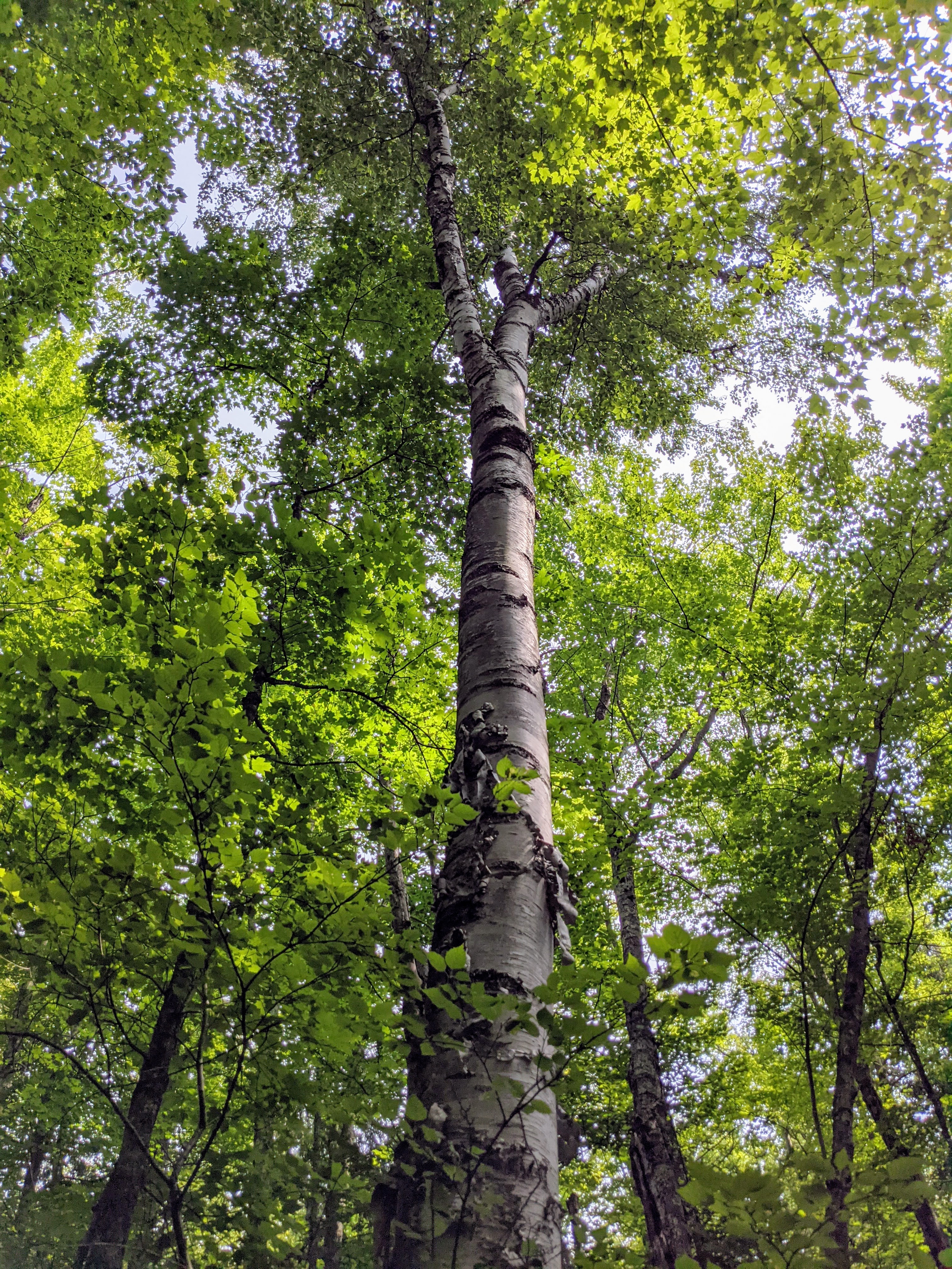
White Birch
"Birch seedlings often colonize burned-over woodlands and fire is responsible for many of upper-Michigan's white birch forests." Who remembers "ribbons" at boy scout camp made from birch bark?

I walked onto the shores of Lake Superior but could not see to far today do to smoke from fires north of here.

Only the shoreline is clear and it seems a little misty too.

Still at great place to read with the waves lapping on the rocky shore.
August 10, 2021

Today's hike is along the Presque Isle River

"The round potholes in the riverbed form where an eddy current continually swirls pebbles and sand grains in a circular path. Over time, the scouring action of these materials wear away the softer shale, forming the large, smooth-sided potholes that you see."


Yikes, the first sign of Fall. I love fall but I am not ready to let go of summer yet.

Jim among the cascades of the Presque Isle River.

Falling water, still one of my favorite things, and this river has plenty of it.

The rock walls along the river a pretty cool as well.

The shale displays its flat feature makes a fine mini waterfall.

Nawadaha Falls from the east side of the river.
"In the language of the native Ojibwa people Nawadaha means "in the midst of a rapids," a name that is especially appropriate in the spring of the year when the river swells with rain and melting snow. During this time of peak flow nearly 12,000 gallons of water tumble over Nawadaha Falls every second."

When we crossed the bridge over the river we came upon this biker gang having a rest stop of Chips Ahoy and Pickles. I chatted with a young driver of a support vehicle who said they would ride 120 miles today on a circuit of the entire Upper Pennisula.

Nawadaha Falls from the west side of the river.

Lower water in August means I can go climb down on the rocks that currently are not covered with water, and of course I did climb down and explore while Jim waited at the overlook.

Getting artsy with up close view of the falls.

Manido Falls
"With a drop of approximately 15 feet, it is the smallest of the waterfalls on the river. It has a crest between 50 and 150 feet, depending on the river volume."

Imagine it 3 times the size when snow melt is at its highest.

Manabezho Falls
"Like many of Upper Michigan's natural features, the waterfalls of the Presque Isle have found names in the language of the native people. The largest falls rightfully take their name from the powerful Ojibwa spirit god Manabezho"

Okay time to climb back up to the truck and check out another trail.
Oh yes, there were plenty of stairs on the west side of this river trail, about 500.

Skies are looking grey but we head out for Overlooked Falls.

A fine little feature of 4 separate falls in one spot.
And then it started to rain, with storms forecasted for the afternoon we head back to the truck.

We picked a spot on the lake to eat our lunch while the rains came down.
After lunch we drove to the boat launch to watch the storm roll out over the lake.

Winds picked up for a short while and this fishing boat came in amidst thunder and lightning.
When we got back to the campsite several tents were blown down and allowed the rain to soak a good bit of the contents of their tents. Another moment when I glad I am in a RV.

The rain cleared the air and allowed for better views from the shoreline of Lake Superior.

Bye bye clouds.

The skies stayed clear and we were able to see lots of stars and the Milky Way.
(Couldn't exactly photograph the Milky Way with the phone camera.)
August 11, 2021

Today we went to Lake of The Clouds
"For many years, Lake of the Clouds, one of Michigan's most famous scenic sites, was known as Carp Lake. This simple name was probably derived from "Lac du Escarpe," French for Lake of the Escarpment. In fact, Lake of the Clouds contains no carp, but does support an excellent smallmouth bass fishery. Carp Lake was renamed Lake of the Clouds in the early 1930s."

Always with our heads in the clouds, enjoying the view.

Most visitors just take the short walk to the overlook, not us, we head into the woods to walk the length of the lake.

Here is the end of the lake and the Carp River beyond.

We stopped for a snack and were entertained by 7 turkey vultures soaring around the lake.

Then it was back to the sun dappled trees.

"The escarpment of the Porcupine Mountains is composed of tilted layers of basalt (a volcanic rock) and sandstone (a sedimentary rock). The escarpment formed because the basalt that caps the ridge is more resistant than the sandstone below. The highest point of the escarpment is nearly 500 feet above Lake of the Clouds."

"Lake of the Clouds is over a mile long, yet is only 15-feet deep. It is fed by the Big Carp River, which enters at the far end of the lake."

The night sky here, now that the clouds and smoke from fires are gone are spectacular.
The bright spot on the left is Jupiter, and to the right Saturn.
(many more stars that my camera on my phone did not capture)
We saw several meteors light up the sky as well.
August 12, 2021

Today we went back into the woods on the Summit Peak Loop Trail

Bonus feature, this 54 stair observation tower.

Great view out to Lake Superior and the Porcupine Mountain Wilderness.

I imagine with fall color this would really be beautiful.

The trail was clearly marked, especially here with color blaze, arrows and limbs blocking the way not to go.

This orange flower, Spotted Touch-Me-Not, caught my eye.
"a summer-blooming Adirondack wildflower bearing one-inch orange flowers with red or dark orange spots"
We were happy to have such a clear day.

The trail had a total of 321 stairs, yes, I counted them.

The trail was well marked, even at this cray point blocking off two trail not to go on.

We arrived at Mirror Lake, this is a back country camp site.

Mirror Lake earns its reflective name.

Jim is scoping out a cabin and row boat on the opposite shore.

Inspired to just fix it, Jim repositions a trail piece that was pulled out by the blown down tree

Suddenly the trail narrowed as we walked on a boardwalk over the marshy area.

We spied this beaver dam along the trail

We also spied this gnawed tree as evidence of beaver,
but alas we did not see the beaver.

Another great day as the sunsets on Lake Superior
August 13, 2021

Today we went to explore the area of the old Nonesuch Mine Company
"none·such ˈnənˌsəCH :a person or thing that is regarded as perfect or excellent"

Test holes/ mineshafts
"It saw its first mining in 1867 and its last in 1912. The mine was opened and closed five different times, each under different ownership. The only time it made a profit was in the period 1879-1881."

"Following the ore body two miles to the east, they reopened the very successful White Pine Mine in 1910 on the same copper bearing formation, the Nonesuch Lode. The Nonesuch Lode would be considered one of the richest beds of copper bearing rock ever to be opened."

Mine shaft
"The White Pine Mine would go on to be Michigan’s most productive copper mine, recording more than 4,000,000,000 pounds of copper extracted during its last 43 years of operation."

A very simple Nonesuch Waterfall, most likely more impressive in the Spring.

The top of the falls separated the Little Iron River into horizontal slats.

A pretty reflection of the blue skies.

What do you do when a tree falls onto the trail?

You work your way over and under it, just like Jim is doing here.

We drove on down the road a bit to hike the Union Mine Trail
"When the Union mine opened in 1846, copper primarily was used to make pots and pars, buttons, sheet roofing, and sheathing for the hulls of wooden ships.
By the late 1890's, copper was in demand for the production of electrical wire. The abundance of copper in Michigan enabled the widespread distribution of electricity in the United States."

"Trap rock, is an old mining term for basalt, a dark colored volcanic rock. Across the river is a large outcrop of traprock."

"Although the Union mine produced masses of copper weighing over 50 pounds, it was unprofitable and closed in 1848. A government report at the time considered the locality "worthless."
It does not look worthless to me.

Stamp Mill
"The gravity stamp mill at the Union mine used a row of cast-iron hammers, each weighing 400 to 500 pounds, to pulverize the copper ore."

Copper or not the Union River is lovely to walk along today.
May 21, 1846 "Went down to the lake after fish in the morning. Worked at the vein. Day fine, but black flies devilish" William Spalding

June 17, 1846 "Worked at the shaft, took out 38 tubs of water and 39 tubs of rock." William Spalding

October 27, 1846 "Everything seems to prosper at this location; we are not only turning out copper, but children. Mrs. Shin gave birth to a whopping baby boy today in the adjoining room to the office." William Spalding

After hiking we headed over to the lakeshore.

What's not to like about a beautiful day at the lake?
Here is a short video so you can see and hear the waves.
August 14, 2021

This morning we headed to the ski area at Porcupine Mountains.

Ranger Katie gave us archery lessons.

I must say these bows that hold the arrow on make it much easier than way back in the day at the YMCA when you had to hold the arrow on.

Jim takes his turn at the square target.

Later he went 4 for 5 on the bear target.

Not to be outdone, I also went 4 for 5 on the bear target. A vast improvement over my first round where I hit the square target only 2 for 5. It was really a fun Ranger activity.

Jim shows how the bear paw on this tiny house (to be set up at campsite 30 next year) is even higher than his reach.

After archery we hit the trail to se Trap Falls.

Ouch, this boardwalk needs more repair than we can do on the fly.

Jim negotiates the broken boardwalk.

It's dark and wet in this part of the forest, this fungus covered tress verifies that.

We arrive at Trap Falls on the mossy covered rocks spilling into a small pool.

It's been a good hike in the woods to a nice little waterfall.

If there is a route to the top of the falls, I have to climb it.

Jim tries out a back country campsite "recliner". Some engineer must have camped here.

Found some bright red color from these berries that hung over the trail.
So many gifts in nature.
August 15, 2021

Sunny Sunday, we head to the shore to read.

Okay, Jim only lasted a few minutes in the sun before seeking shade.

And I only lasted so long sitting before I took off to hike along the shore.

At times the hike was at a slight angle which made it a little more fun.

Time to say goodbye to Lake Superior and the Porcupine Mountains.
Tomorrow we start our journey back home.
water, water, and more water, among cool rocks and lovely trees - gotta love it
ReplyDelete